IMD Issues Heavy Rain Alert for 5 Tamil Nadu Districts Today
Heavy Rain Alert: IMD Warns of Intense Downpours in 5 Tamil Nadu Districts Today Amid Bay of Bengal Circulation
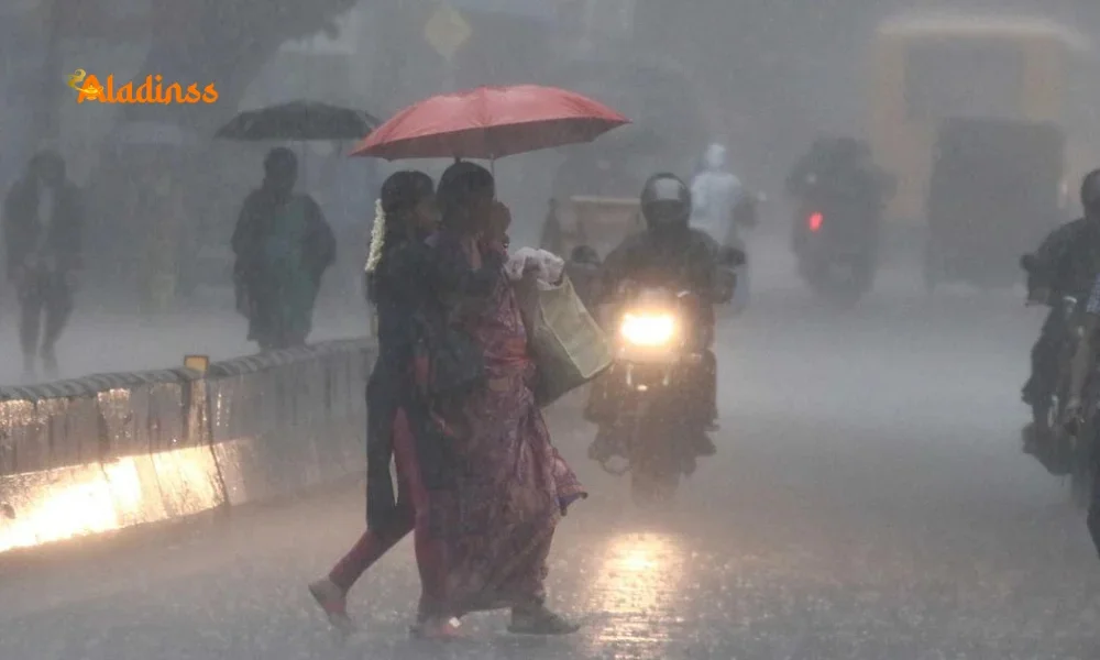
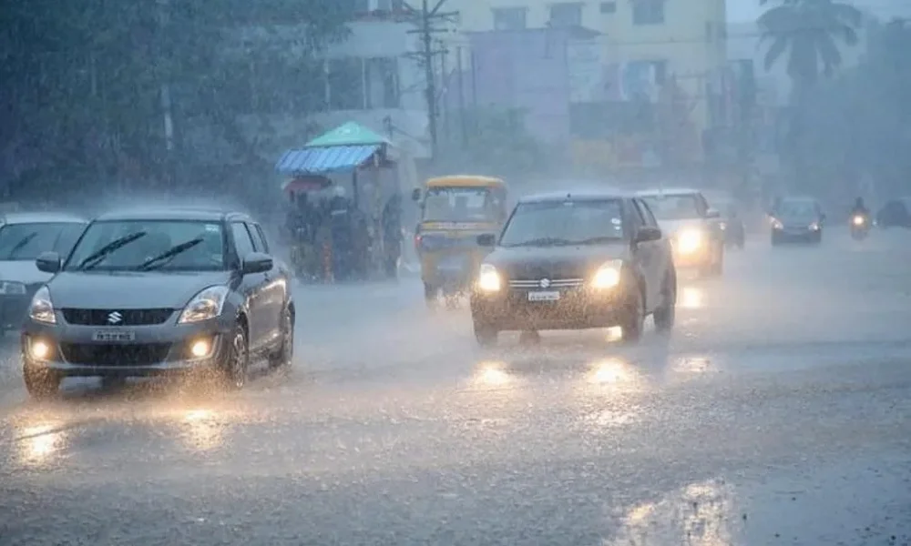
As an atmospheric circulation brews over South Sri Lanka and the adjacent southwest Bay of Bengal, the India Meteorological Department (IMD) has issued a urgent heavy rain alert for five key districts in Tamil Nadu on November 14, 2025. This dynamic weather system promises light to moderate showers with thunder and lightning across the state, but isolated heavy downpours could lash the hilly terrains of Tirunelveli, Theni, Tenkasi, Kanyakumari, and Thoothukudi, raising concerns for flash floods and disruptions in these vulnerable southern pockets. With Chennai and suburbs bracing for partly cloudy skies and sporadic light rain, temperatures hovering between 25-26°C minimum and 32°C maximum, residents are urged to stay vigilant amid gusty winds up to 55 kmph along the southeast coast, Gulf of Mannar, and Kumarikadal regions.
The IMD's bulletin, released early Friday, underscores the circulation's potential to intensify, drawing moisture from the warming Bay of Bengal and channeling it northward. This setup, typical of late Northeast Monsoon phases, could swell rivers like Tamirabarani in Tirunelveli and Vaigai in Theni, echoing last year's deluges that displaced thousands. Fisherfolk face the sternest advisory: avoid venturing into cyclonic-prone seas where swells of 35-45 kmph, peaking at 55 kmph, threaten small vessels. As Tamil Nadu's 5.9 crore populace navigates this wet spell, the alert extends forecasts for escalated rains on November 16 and 17, blanketing central delta districts like Mayiladuthurai, Nagapattinam, Thiruvarur, Thanjavur, and Pudukkottai, plus urban corridors from Tiruvallur to Cuddalore.
This circulation, born from low-pressure troughs over the equator, signals the Northeast Monsoon's vigor, which contributes 35 percent of Tamil Nadu's annual rainfall. Historical parallels 2015's Chennai floods from similar setups heighten preparedness calls from the State Disaster Management Authority (SDMA), which has mobilized NDRF teams in Madurai and Tuticorin. Urban commuters in Chennai, where light drizzles may slick roads, should monitor live radar feeds via IMD's app for real-time updates.
Beyond immediate threats, this weather event spotlights climate vulnerabilities: rising sea temperatures, up 0.5°C since 2020 per IMD data, fuel fiercer circulations, prolonging monsoons into December. For agriculture-dependent districts like Theni (cardamom hills) and Kanyakumari (rubber estates), bountiful rains could boost yields but risk landslides in fragile Western Ghats slopes.
Decoding the Atmospheric Circulation: Science Behind the Downpours
At its core, the prevailing atmospheric circulation is a low-level cyclonic vortex, spanning 500 km, fed by the Inter-Tropical Convergence Zone (ITCZ) shifting south. IMD's Chennai center, monitoring via Doppler radars in Tuticorin and Karaikal, tracks this system's northwest trajectory, pulling humid air over Tamil Nadu's 1,300 km coastline. Thunderstorms, with cumulonimbus clouds towering 12 km, will dominate, discharging 20-50 mm/hour bursts enough to inundate low-lying Tenkasi farmlands in 2-3 hours.
Satellite imagery from INSAT-3D reveals moisture plumes from the Maldives, converging with Sri Lanka's orographic lift, amplifying orographic rains in Kanyakumari's hills (up to 100 mm expected). Winds, veering southwesterly at 15-20 knots, will whip up rough seas, with wave heights cresting 2.5 meters in Gulf of Mannar a peril for 50,000 coastal fishers whose livelihoods hinge on daily hauls.
Climatologically, November peaks Tamil Nadu's rainfall at 300 mm statewide, but 2025's La Niña hangover cooler Pacific waters could extend this to 400 mm, per IMD models. Historical spikes, like 2005's 1,200 mm in Tirunelveli, underscore the need for resilient infrastructure: check dams in Thoothukudi, early warning sirens in Theni.
District-Wise Breakdown: Impacts and Preparedness in Southern Tamil Nadu
Tirunelveli, gateway to the Ghats, faces the brunt: its 4,000 sq km basin, home to 3 million, risks Tamirabarani overflows, submerging Kalakadu farms. District Collector Geretic J has activated 50 relief camps, urging 1 lakh hill residents to stock essentials. Theni, with its misty Cumbum valley, anticipates 80 mm deluges, threatening cardamom yields (Rs 500 crore annual) farmers advised sandbagging via Krishi Vigyan Kendra alerts.
Tenkasi's courtallam falls could swell to torrent levels, drawing eco-tourists but endangering bridges; SDMA drills simulate evacuations for 20,000. Kanyakumari, Tamil Nadu's southern tip, sees Nagercoil roads prone to waterlogging, with lighthouse views obscured by squalls tourism dips 30 percent in rains, per TTDC. Thoothukudi, industrial hub with Vedanta ports, braces for Tuticorin harbor disruptions; winds could halt 200 vessels, costing Rs 100 crore daily.
Across these districts, 15 NDRF battalions stand ready, with drone surveillance over 500 vulnerable spots. Power outages loom TANGEDCO pre-positions 5,000 transformers while health teams combat leptospirosis spikes, as seen in 2023's 500 cases.
- Tirunelveli: Flash flood risk high; 100 mm expected, river gauges at red alert.
- Theni: Landslide-prone hills; evacuations for 5,000 in Bodi forests.
- Tenkasi: Waterfalls surge; tourism advisories, road closures on SH-40.
- Kanyakumari: Coastal erosion; beach shacks dismantled, fishing bans enforced.
- Thoothukudi: Port delays; chemical plants on standby, air quality dips with humidity.
Extended Forecast: Delta Deluge on November 16-17 and Chennai Outlook
The circulation's northward creep forecasts escalation: November 16 targets Cauvery delta Mayiladuthurai's paddy fields (harvesting 2 lakh hectares) face inundation, with 70 mm bursts swelling Coleroon river. Nagapattinam-Thiruvarur-Thanjavur trio, Tamil Nadu's rice bowl, risks crop losses (Rs 1,000 crore potential), prompting irrigation boards to release 5,000 cusecs from Mettur dam.
By November 17, rains sprawl to northern coastal belt: Tiruvallur-Chennai-Kanchipuram see urban flooding in Pallikaranai marsh, Chengalpattu's GST road logjams. Villupuram-Kallakurichi-Cuddalore, cyclone-prone, activate 200 shelters; Mayiladuthurai repeats with Karaikal swells. Puducherry, under joint IMD watch, mirrors 60 mm averages, with winds veering 40 kmph.
Chennai's respite: partly cloudy with 10-15 mm scatters, humidity at 85 percent fostering muggy discomfort. Metro forecasts: T Nagar markets slick, airport delays minimal (10 flights rerouted last similar spell). IMD's ensemble models predict 200 mm cumulative by month's end, easing drought but straining Chennai's 1,200 km stormwater drains.
Fishermen's Peril: Squalls and Safety Protocols in Southeast Seas
The IMD's gale warning 35-45 kmph sustained, gusts to 55 kmph spells doom for mechanized boats in South Tamil Nadu's 500 km EEZ. Gulf of Mannar's pearl divers and Kumarikadal's squid trawlers, 10,000 strong, heed bans, docking at Tuticorin harbor where 200 vessels idle, losses mounting Rs 50 lakh daily. Southwest Bay's swells, 2-3 meters, mirror 2024's Cyclone Remal disruptions.
Fisheries Department deploys 50 patrol boats, life vests mandatory; apps like INCOIS warn via SMS to 2 lakh registered users. Post-monsoon, this circulation boosts sardine hauls, but immediate peril: 5 vessels capsized in 2023 analogs, claiming 12 lives. Alternatives: inland aquaculture in Theni ponds yields 20 tons weekly.
Economic ripple: seafood prices spike 20 percent in Chennai markets, protein access strained for 5 million coastal poor.
Climate Lens: How Warming Waters Amplify Tamil Nadu's Monsoon Fury
This circulation exemplifies anthropogenic shifts: Bay of Bengal's 1°C warming since 1980, per IPCC, supercharges evaporation, yielding 20 percent more intense rains. Tamil Nadu, with 1,000 km vulnerable coast, logs 50 flood events/decade, up from 20 in 1990s Chennai's 2021 deluge (1,200 mm) a stark reminder.
Adaptation strides: Tamil Nadu's Climate Action Plan 2023 invests Rs 10,000 crore in mangroves (50,000 hectares in Cuddalore), sponge cities in Chennai (50 parks absorbing 100 mm). Yet gaps persist: 30 percent rural homes flood-prone, per TNSDMA. Global parallels: Sri Lanka's 2024 landslides from akin circulations claim 200 lives.
Future: IMD's downscaling models forecast 15 percent rain hike by 2050, urging resilient crops like flood-tolerant rice in Thanjavur.
Community Resilience: Tips for Navigating the Wet Onslaught
For residents: stock 3-day kits (water, torches), avoid low bridges in Tenkasi; apps like Tamil Nadu Rain Radar provide hyper-local alerts. Farmers in Thoothukudi: harvest early, use tarps on tobacco fields. Urbanites in Chennai: clear gullies, opt for MRTS over roads.
Health watch: mosquito nets against dengue surges (2024's 10,000 cases); boil water in Nagapattinam. Schools in Kanyakumari: hybrid classes if >50 mm falls. Economic buffers: PM Fasal Bima for 5 lakh insured in delta districts.
As November 14, 2025, unfolds, Tamil Nadu's spirit from fisherwomen mending nets to hill folk fortifying homes embodies resilience. This rain, while perilous, replenishes aquifers, greening a parched land.
In the IMD's watchful gaze, today's alert isn't alarmism; it's armor against nature's whims. Stay safe, Tamil Nadu the monsoon's gift comes wrapped in clouds.
Facebook Comments


-
 Explore the upcoming Tamil film Maaman - cast, sto...
 -
 Read the ACE (2025) movie review starring Vijay Se...
 -
 Check out Maaman's 1st day box office collection a...
 -
 Explore tourist family reviews for Maaman movie –...
Popular Posts
Vote / Poll
Recent Posts


Recommended Posts

-
 Discover the best schools in Nagercoil f...
 -
 Discover the top-rated preschools in Nag...
 -
 Explore the best schools in Nagercoil th...

Comment / Reply From