Early NE Monsoon in TN: Orange Alert for 5 Districts
October 17, 2025
Early Northeast Monsoon Lashes Tamil Nadu: Orange Alert Issued for 5 Districts Amid Intense Downpours
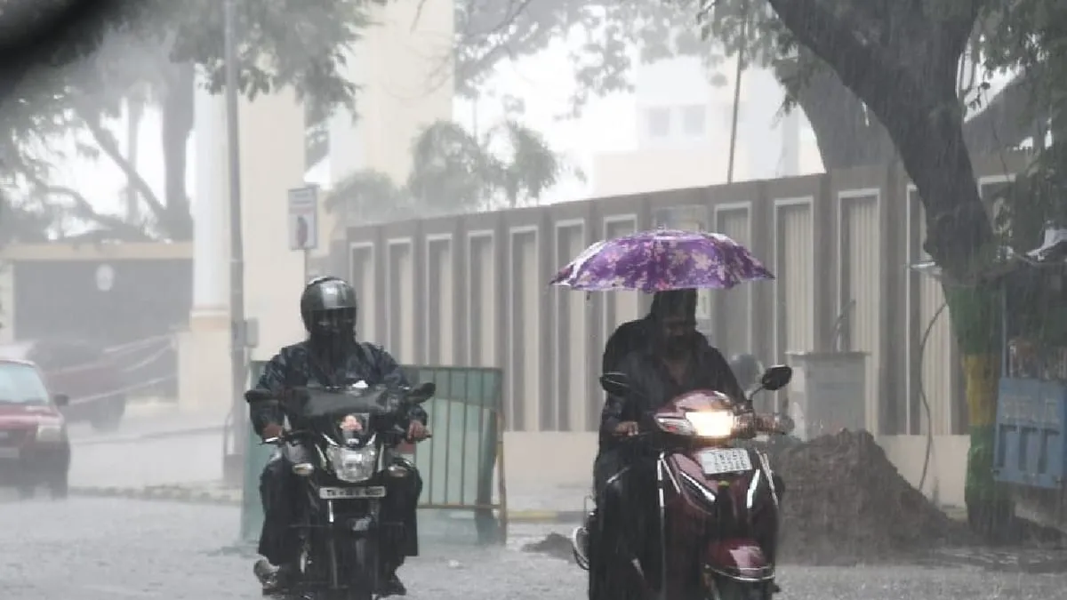
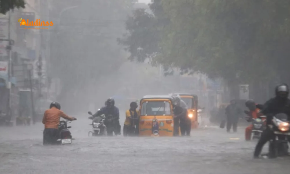
Tamil Nadu is bracing for a deluge as the northeast monsoon makes an unusually early arrival, triggering widespread heavy rains across the state. The India Meteorological Department (IMD) confirmed the onset on October 16, 2025, a day ahead of typical timelines, with an orange alert in place for five southern districts today. This premature start to the TN weather season promises intense showers, potentially disrupting daily life and agriculture in the coming days.
IMD's Southern Region Director, Amutha, announced the development during a media briefing in Chennai, highlighting a brewing low-pressure system in the Arabian Sea slated for October 18, followed by another in the Bay of Bengal around October 24. These systems could amplify the monsoon activity, leading to prolonged wet spells through late October. For now, the focus is on immediate threats, with very heavy rainfall (12-20 cm) forecasted for Virudhunagar, Thoothukudi, Tirunelveli, Kanyakumari, and Tenkasi districts on October 17.
Residents in these areas are advised to stay indoors and monitor updates, as flash floods and waterlogging pose significant risks. The early northeast monsoon in Tamil Nadu not only signals relief from pre-monsoon heat but also raises concerns over preparedness in vulnerable coastal and delta regions.
District-Wise Rainfall Warnings: From Orange to Yellow Alerts Across TN
The IMD's bulletin underscores the severity in the southern belt, where the orange alert signals a high probability of very heavy downpours that could exceed 20 cm in isolated pockets. Beyond these hotspots, heavy rains (7-11 cm) are expected in a swath of districts including Madurai, Sivaganga, Ramanathapuram, Theni, Dindigul, Tiruppur, Erode, Nilgiris, and Coimbatore. Delta regions like Mayiladuthurai, Nagapattinam, Thiruvarur, Thanjavur, and Pudukkottai also face similar threats, with potential for localized flooding in low-lying areas.
This tiered alert system-orange for extreme caution and yellow for moderate-aims to guide state authorities in deploying relief measures proactively. Farmers in rain-fed zones are particularly watchful, as the early onset could boost reservoir levels but risks crop damage if intensity spikes unexpectedly.
- Virudhunagar and Thoothukudi: Expect thunderstorms with gusty winds up to 40 kmph.
- Tirunelveli and Kanyakumari: Coastal erosion likely due to rough seas accompanying rains.
- Tenkasi: Hill tracts vulnerable to landslides amid heavy spells.
The forecast extends till October 22, with enhanced activity over Kerala, Tamil Nadu, and Puducherry, marking a robust start to the season that typically contributes 40% of the state's annual rainfall.
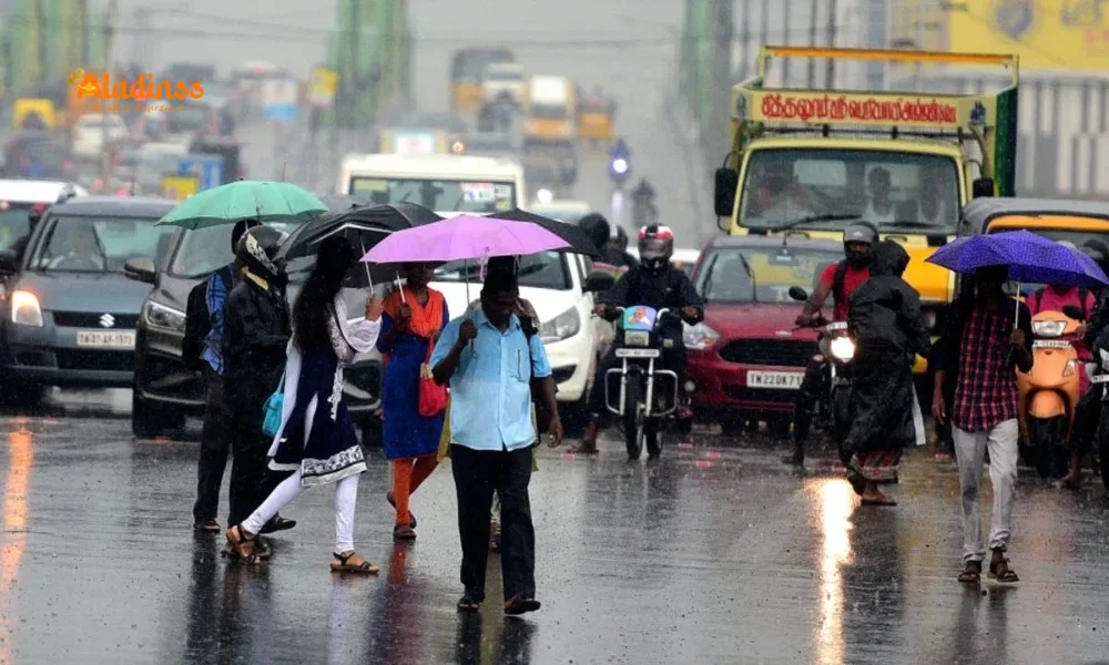
Chennai's Mild Outlook: Partly Cloudy Skies with Scattered Showers
In the capital, Chennai and its suburbs will see a more temperate TN weather pattern: partly cloudy conditions interspersed with light rains and isolated thundershowers. Temperatures are set to hover between a high of 32°C and a low of 25-26°C, offering some respite from the lingering humidity. While not under alert, urban areas could experience waterlogging in underpasses during evening bursts.
The yellow alert for Chennai lingers till October 17, advising commuters to plan routes via elevated corridors. With the Adyar and Cooum rivers swelling from upstream inflows, civic bodies have ramped up desilting operations to mitigate urban flooding risks.
This balanced forecast allows for normalcy in northern districts, but vigilance remains key as the low-pressure developments could shift patterns northward by week's end.
Why This Early Onset? Meteorological Factors Driving the Surge
The northeast monsoon's premature kickoff traces to favorable atmospheric cues: a retreating southwest monsoon and warming sea surface temperatures in the Bay of Bengal. IMD's analysis points to cyclonic circulations over the Andaman Sea, funneling moisture-laden winds toward Tamil Nadu's coast. The impending Arabian Sea low on October 18 may draw in cross-equatorial flows, intensifying the system further.
Historically, early arrivals like this-last seen in 2022-have led to bumper harvests in the Cauvery delta but also flash flood woes in urban pockets. Climate experts link the trend to La Niña influences, promising above-normal rains (over 400 mm) for the season spanning October to December.
Satellite imagery from the weekend shows robust cloud bands aligning over the southern peninsula, corroborating the IMD's proactive alerts. As the Bay of Bengal low brews by October 24, sustained vigilance is essential for the entire state.
Impacts and Preparedness: Safeguarding Lives and Livelihoods
The orange alert districts, predominantly agrarian, face dual-edged impacts: replenished groundwater versus potential inundation of paddy fields. In Thoothukudi and Kanyakumari, fishing communities have been urged to secure vessels, with ports on standby for rough seas. State disaster management teams have prepositioned sandbags and relief kits, drawing lessons from 2023's deluge that displaced thousands.
Educational institutions in alert zones may opt for online classes, while highways like NH-44 could see diversions. The Tamil Nadu government, via Revenue Minister KN Nehru, has activated control rooms in all 38 districts, ensuring 24/7 monitoring.
On the positive side, the early northeast monsoon in Tamil Nadu could accelerate sowing for rabi crops, benefiting smallholders if drainage holds. Hydel projects in the Western Ghats anticipate fuller reservoirs, aiding power generation through the dry months.
Looking Ahead: Extended Forecast and Climate Resilience Strategies
Post-October 22, the IMD anticipates a brief lull before the Bay low reignites activity, with isolated heavy spells persisting till month-end. Northern interiors like Salem and Dharmapuri may see spillover rains, while coastal Tamil Nadu remains the epicenter.
Long-term, the state is investing in climate-resilient infrastructure: smart drainage in Chennai's IT corridor and early warning apps for farmers. Collaborations with IMD for hyper-local forecasts are enhancing response times, crucial as erratic patterns become the norm.
As October 17, 2025, unfolds, Tamil Nadu's spirit shines through the showers-a testament to resilience amid nature's whims. Stay tuned for hourly updates as the season unfolds.
Comment / Reply From
No comments yet. Be the first to comment!