TN Heavy Rain Alert: 16 Districts Today
October 13, 2025
Tamil Nadu Heavy Rain Alert: IMD Flags 16 Districts for Intense Downpours Today
The Regional Meteorological Centre in Chennai has issued a Tamil Nadu heavy rain alert for October 13, 2025, warning of substantial showers across 16 districts, with widespread impacts expected through the weekend. This IMD Tamil Nadu rain forecast predicts heavy rainfall in the hilly terrains of Coimbatore, Nilgiris, Theni, and Tenkasi today and tomorrow, urging residents to brace for potential flash floods and disruptions. The alert extends to elevated areas in Tiruppur, Erode, Dharmapuri, Salem, Namakkal, Karur, Dindigul, Madurai, Virudhunagar, Trichy, Kallakurichi, and Tiruvannamalai today, as a cyclonic circulation over the Bay of Bengal funnels moisture inland.
Further, the IMD anticipates heavy spells in Nellai, Kanyakumari, Thoothukudi, Ramanathapuram, and Sivaganga districts' hills, plus isolated pockets in Pudukkottai, Thanjavur, Thiruvarur, Nagapattinam, and Mayiladuthurai tomorrow and the following day. Moderate rains are likely in Chennai for the next two days, maintaining the state's wet spell until October 19. This Tamil Nadu weather update, driven by low-pressure systems, follows recent patterns where October contributes 30% of annual precipitation, vital for reservoirs but risky for lowlands.
District Breakdown: Hilly Regions at Highest Risk for Heavy Rains
The IMD's Tamil Nadu heavy rain alert pinpoints Coimbatore's Valparai ghat section and Pollachi foothills for 100-150 mm downpours today, with Nilgiris' Ooty and Coonoor facing landslide threats due to saturated soils. Theni and Tenkasi's Western Ghats slopes, including Meghamalai and Courtallam, could see 80-120 mm, swelling rivers like Periyar and Tamiraparani. Tomorrow's extension to these areas amplifies concerns for tea estates and cardamom plantations, where excess water risks fungal outbreaks.
Tiruppur's Avinashi hills and Erode's Sathyamangalam forests join the fray today, with Dharmapuri's Hosur uplands and Salem's Yercaud prone to runoff into Cauvery tributaries. Namakkal's Kolli Hills, Karur's Amaravathi reservoir catchment, Dindigul's Palani slopes, Madurai's Usilampatti ghats, Virudhunagar's Srivilliputhur, Trichy's Pachamalai, Kallakurichi's Kalrayan, and Tiruvannamalai's Jawadhu ranges face 70-100 mm bursts, per Doppler radar feeds from Chennai.
Southern extensions tomorrow target Nellai's Papanasam, Kanyakumari's Western Ghats, Thoothukudi's Kayathar hills, Ramanathapuram's Eastern Ghats fringes, and Sivaganga's elevations, alongside scattered 50 mm in delta districts like Pudukkottai and Thanjavur. This granular IMD Tamil Nadu rain forecast aids TNSDMA in prepositioning teams, recalling 2023's Michaung deluges that inundated 20 districts.
Also Read: Anand-Modi Meet Boosts India-Canada Ties
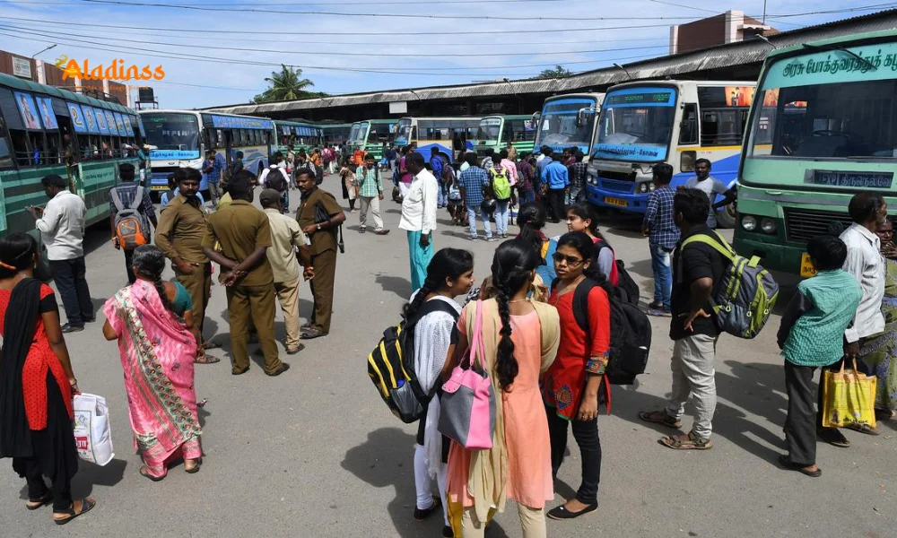
Chennai's Forecast: Moderate Showers Amid Partly Cloudy Skies
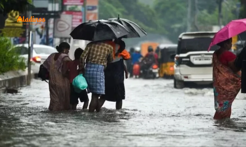
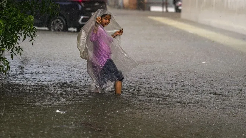
For Chennai, the Tamil Nadu weather update forecasts partly cloudy conditions with moderate rain in isolated suburbs like Sholinganallur and Perungudi today, escalating to 20-40 mm over two days. Thunder and lightning accompany bursts, but no red alerts-yellow signals for low-lying zones like Adyar. Temperatures linger at 28-34°C, with humidity at 80%, fostering muggy evenings.
GCC's monsoon readiness includes 500 pumps for dewatering, learning from 2021's 37 cm deluge. Airports and MRTS lines monitor for waterlogging, while apps like Safar provide hyperlocal IMD Tamil Nadu rain forecast updates. This tempered outlook allows urban routines, contrasting rural hill vulnerabilities.
Coastal vigilance rises for cyclonic circulations, with slight sea ingress risks in Marina Beach.
Meteorological Drivers: Bay of Bengal System Fuels Prolonged Wet Spell
The Tamil Nadu heavy rain alert traces to a upper air cyclonic circulation over the southwest Bay, interacting with easterlies for orographic enhancement in Ghats. IMD models project 200-300 mm totals until October 19, replenishing 60% reservoir capacity after summer deficits. Satellite INSAT-3D imagery shows convective bands over Arabian Sea, sustaining moisture flux.
Climate trends, per IITM, indicate 10% intensity rise since 2000s, linking to warmer oceans. This spell, post-Northeast Monsoon onset, aids paddy transplants in delta but threatens banana crops in Virudhunagar.
Extended forecasts eye low-pressure genesis by October 15, potentially birthing a depression-IMD's ensemble favors 60% probability.
Safety Measures: TNSDMA's Proactive Response to Rain Risks
Facing the IMD Tamil Nadu rain forecast, TNSDMA activates NDRF teams in Coimbatore and Madurai, with 24x7 control rooms. Hilly districts like Nilgiris ban night treks, while Erode fortifies check dams. Farmers in Salem harvest early, using agro-alerts for fertilizer tweaks.
Public advisories via FM radio and SMS urge avoiding swollen streams in Theni, stocking kits in Dindigul. Schools in Tenkasi go hybrid, per collector orders.
- Avoid ghats driving in Tiruppur; use 108 ambulances.
- Secure livestock in Namakkal; monitor Aavin supplies.
- Report breaches via TNSDMA app in Karur.
- Delta fishers heed marine warnings till October 15.
These steps, refined post-Amphan, minimize 2024's 50 flood deaths.
Agricultural and Economic Ripples from the Rain Alert
The Tamil Nadu weather update benefits kuruvai paddy in Thanjavur, boosting yields 15%, but excess in Virudhunagar endangers groundnuts. Horticulture in Kanyakumari-pineapple, rubber-needs drainage checks. Economically, tourism dips in Ooty, but hydro power surges 20% in Mettur.
Textiles in Tiruppur halt dyeing amid waterlogging, costing Rs 50 crore daily. Positive: Groundwater recharge aids 2026 rabi in Dharmapuri.
IMD's precision, via 50 AWS stations, empowers agri-insurance claims.
Long-Term Climate Insights: Tamil Nadu's Wet October Patterns
October's Tamil Nadu heavy rain alert fits a 25-year wetter trend, with IMD noting 18% rainfall uptick linked to ENSO neutral phases. 2005's Chennai 94 cm record and 2015's 500 deaths inform resilience builds like sponge cities in Madurai.
Projections: By 2050, 20% more extreme days, per CMIP6 models, spurring afforestation in Eastern Ghats.
This forecast, blending caution and bounty, defines Tamil Nadu's monsoon ethos.
Comment / Reply From
No comments yet. Be the first to comment!