Rain Alert Tamil Nadu: Heavy Rain Forecast in 5 Districts Today, Met Department Issues Major Warning
September 19, 2025
Rain Alert Tamil Nadu: Heavy Rain Forecast in 5 Districts Today, Met Department Issues Major Warning
The Regional Meteorological Centre has issued a critical weather alert for Tamil Nadu, warning residents of heavy rainfall expected across five districts today. The Indian Meteorological Department has forecast widespread rainfall with isolated heavy to very heavy downpours due to a low-pressure system developing over the Bay of Bengal, creating significant weather concerns for the affected regions.
According to the latest meteorological bulletin issued by the Chennai Regional Meteorological Centre, a low-level atmospheric circulation is currently prevailing over South Indian regions, creating favorable conditions for sustained rainfall activity. This weather system is expected to bring substantial precipitation to multiple districts, prompting authorities to issue precautionary advisories for residents and various sectors.
Five Districts Under Heavy Rain Warning
The meteorological department has specifically identified five districts where heavy rainfall is most likely to occur at isolated locations today. These districts include Tiruvallur, Ranipet, Tiruvannamalai, Vellore, and Kanchipuram, all of which fall within the northern and central regions of Tamil Nadu.
Tiruvallur district, located in the northern part of Tamil Nadu and adjacent to Chennai, is expected to experience significant rainfall that could affect both urban and rural areas. The district's proximity to the Bay of Bengal makes it particularly susceptible to weather systems originating from oceanic low-pressure areas.
Ranipet district, which was carved out of Vellore district in 2019, encompasses important industrial and agricultural areas that could be significantly impacted by heavy rainfall. The district's manufacturing sectors and agricultural activities may face disruptions if the predicted rainfall intensity materializes as forecasted.
Tiruvannamalai district, known for its spiritual significance and agricultural importance, could see heavy downpours affecting both pilgrimage activities and farming operations. The district's hilly terrain may experience enhanced rainfall due to orographic effects, potentially leading to localized flooding in low-lying areas.
Current Weather Pattern and Atmospheric Conditions
The meteorological analysis indicates that a low-level circulation system is currently established over South Indian regions, creating a conducive environment for sustained rainfall activity. This atmospheric pattern typically results in moisture-laden air masses being drawn inland from the surrounding ocean bodies, leading to enhanced precipitation across the affected regions.
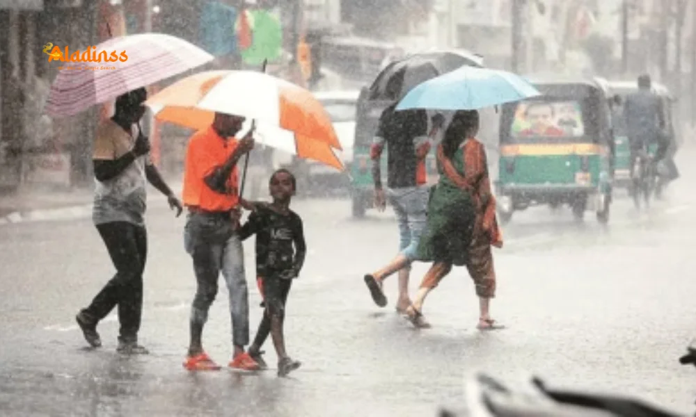
Light to moderate rainfall is expected to occur at several locations across Tamil Nadu, Puducherry, and Karaikal regions throughout the day. The weather system is also generating strong surface winds with thunderstorm activity, creating potentially hazardous conditions for outdoor activities and transportation.
Wind speeds are forecast to reach 30 to 40 kilometers per hour, accompanied by thunder and lightning activity. These strong winds could pose additional risks to temporary structures, outdoor advertising displays, and tree branches that may already be weakened by previous weather events.
The combination of heavy rainfall and strong winds creates compound weather risks that require enhanced preparedness measures from local authorities, emergency services, and residents in the affected districts. Power supply networks may experience disruptions due to the combined effects of rain and wind on electrical infrastructure.
Temperature Forecast and Heat Index Concerns
Despite the rainfall forecast, meteorological analysis indicates that maximum temperatures across Tamil Nadu, Puducherry, and Karaikal regions are likely to experience a gradual increase of up to 2 degrees Celsius at several locations. This temperature rise pattern reflects the complex interaction between monsoon systems and regional atmospheric conditions.
The anticipated temperature increase means that maximum temperatures in the affected regions could be 2 to 3 degrees Celsius above normal levels for this time of year. This elevation in temperature, combined with increased humidity from rainfall activity, may result in uncomfortable heat index conditions despite the presence of precipitation.
The concurrent occurrence of rainfall and elevated temperatures creates unique challenges for public health management, particularly for vulnerable populations including elderly residents, outdoor workers, and individuals with pre-existing health conditions. Heat-related stress may persist even during rainy periods due to increased atmospheric moisture content.
Agricultural sectors may face additional stress from this temperature-rainfall combination, as crops and livestock require careful management during periods of high humidity and fluctuating weather conditions. Farmers are advised to monitor their operations closely and implement appropriate protective measures for sensitive agricultural activities.
Chennai Metropolitan Area Weather Update
The Chennai metropolitan area and its surrounding suburbs are expected to experience partly cloudy sky conditions throughout the day, with light to moderate rainfall accompanied by thunderstorm activity forecast for several locations within the city limits. This weather pattern reflects the broader regional atmospheric conditions affecting the northern Tamil Nadu districts.
Temperature projections for Chennai indicate maximum temperatures ranging between 34 to 35 degrees Celsius, while minimum temperatures are expected to remain in the range of 26 to 27 degrees Celsius. These temperature ranges are consistent with typical pre-monsoon conditions but may feel more oppressive due to increased humidity levels.
The partly cloudy conditions in Chennai suggest intermittent sunshine between periods of cloud cover, which could lead to rapid changes in local weather conditions throughout the day. Residents and commuters should be prepared for sudden shifts between sunny and rainy conditions, particularly during afternoon and evening hours.
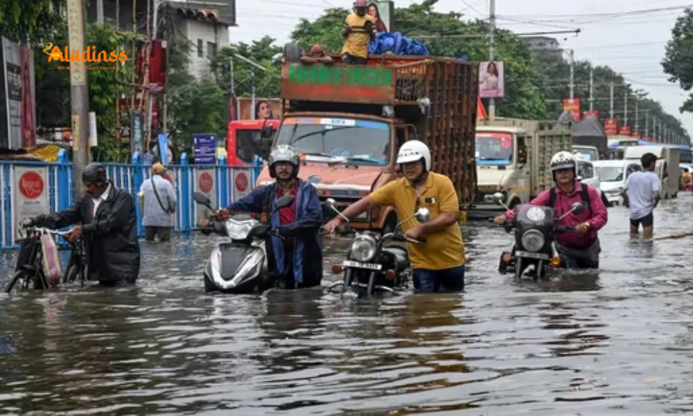
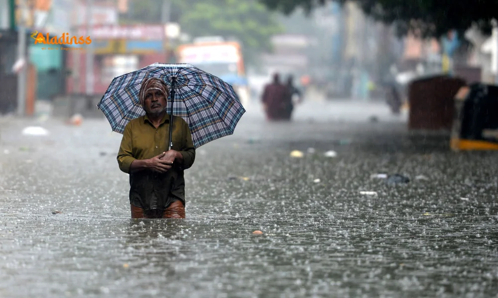
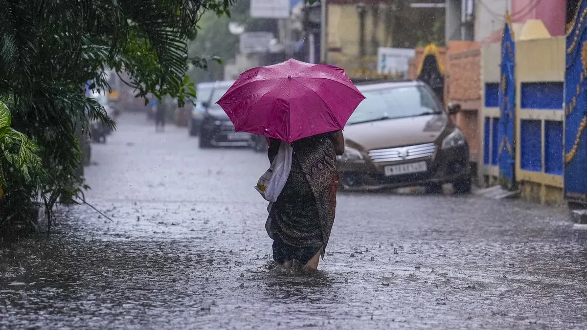
Urban flooding remains a concern for Chennai, particularly in areas known for poor drainage infrastructure. The combination of moderate rainfall with thunderstorm activity could overwhelm existing drainage systems in vulnerable neighborhoods, leading to temporary waterlogging and transportation disruptions during peak rainfall periods.
Marine Weather Warning for Fishermen
The meteorological department has issued a critical marine weather warning, strongly advising fishermen against venturing into several sea areas due to predicted cyclonic storm conditions. The affected marine zones include the southern Tamil Nadu coast, Gulf of Mannar, adjoining Kumari Sea areas, extensive sections of the southern Bay of Bengal, and Andaman Sea regions.
Additionally, portions of the southwest-central Arabian Sea are expected to experience adverse weather conditions that could pose significant risks to fishing vessels and other marine activities. These warnings reflect the comprehensive nature of the current weather system, which extends across multiple oceanic regions surrounding the Indian peninsula.
Cyclonic conditions over these marine areas typically involve wind speeds exceeding safe operational limits for fishing boats and small vessels. Wave heights may also increase substantially, creating dangerous conditions for navigation and fishing operations. Fishermen who have already ventured out are advised to return to harbor immediately.
The marine warning extends to recreational boating activities, coastal tourism operations, and port activities that may be affected by rough sea conditions. Harbor authorities and coast guard services are likely implementing enhanced monitoring and safety protocols to ensure marine safety during this weather event.
Agricultural Sector Impact and Preparedness
The heavy rainfall forecast for the five districts carries significant implications for agricultural operations, particularly during the current crop season. Farmers in Tiruvallur, Ranipet, Tiruvannamalai, Vellore, and Kanchipuram districts should implement immediate protective measures for crops that are sensitive to waterlogging or excessive moisture exposure.
Standing water crops such as paddy may benefit from the additional rainfall if proper drainage systems are maintained, while other crops including vegetables, cotton, and sugarcane may require protective measures to prevent damage from excessive water accumulation. Harvesting operations for ready crops should be expedited where possible before the onset of heavy rainfall.
Livestock management becomes critically important during heavy rainfall events, as animals require adequate shelter and clean water sources. Poultry operations are particularly vulnerable to sudden weather changes and may need enhanced ventilation and protection systems to maintain productivity and animal health.
Agricultural machinery and equipment should be secured or moved to covered areas to prevent damage from rain and strong winds. Farm infrastructure including storage facilities, greenhouses, and temporary structures should be reinforced or evacuated as necessary to minimize potential losses.
Urban Infrastructure and Transportation Concerns
The predicted heavy rainfall poses significant challenges for urban infrastructure systems across the five affected districts. Drainage networks, particularly in rapidly urbanized areas, may experience stress from sudden influxes of rainwater, potentially leading to street flooding and disruption of normal city functions.
Transportation systems including roadways, railways, and public transit services should prepare for potential disruptions caused by waterlogging, reduced visibility, and unsafe driving conditions. Commuters are advised to plan for longer travel times and consider alternative routes during peak rainfall periods.
Power distribution networks face increased vulnerability during combined rain and wind events, as electrical infrastructure may be affected by fallen trees, flooding of substations, or lightning strikes. Utility companies typically implement emergency response protocols to minimize service interruptions and ensure rapid restoration of services.
Educational institutions, healthcare facilities, and emergency services should review their contingency plans and ensure adequate preparedness for weather-related challenges. Schools may need to adjust schedules or implement safety protocols to ensure student and staff safety during the weather event.
Public Safety Recommendations and Emergency Preparedness
Residents in the five districts under heavy rain warning should implement immediate safety measures to protect themselves and their property during the forecasted weather event. Emergency supplies including flashlights, batteries, first aid materials, and adequate food and water reserves should be readily accessible.
Outdoor activities should be minimized or postponed during peak rainfall periods, particularly when thunderstorm activity is present. Lightning poses serious risks to individuals in open areas, and strong winds can create hazardous conditions for pedestrians and vehicle operators.
Building maintenance issues such as roof leaks, blocked drainage systems, or structural weaknesses should be addressed immediately before the heavy rainfall begins. Property owners should ensure that gutters and drainage systems are clear of debris to facilitate proper water flow and prevent structural damage.
Emergency contact information for local authorities, utility companies, and emergency services should be easily accessible. Mobile phone batteries should be fully charged, and backup power sources should be available in case of extended power outages during the weather event.
Vehicle operators should exercise enhanced caution during rainfall periods, maintaining reduced speeds, increasing following distances, and using appropriate lighting systems. Flooding of underpasses and low-lying roads is possible, and drivers should avoid attempting to navigate through waterlogged areas where water depth cannot be accurately assessed.
Comment / Reply From
No comments yet. Be the first to comment!