IMD Heavy Rain Alert for 7 Tamil Nadu Districts
October 10, 2025
Heavy Rain Alert for Tamil Nadu: IMD Predicts Intense Downpours in Key Districts
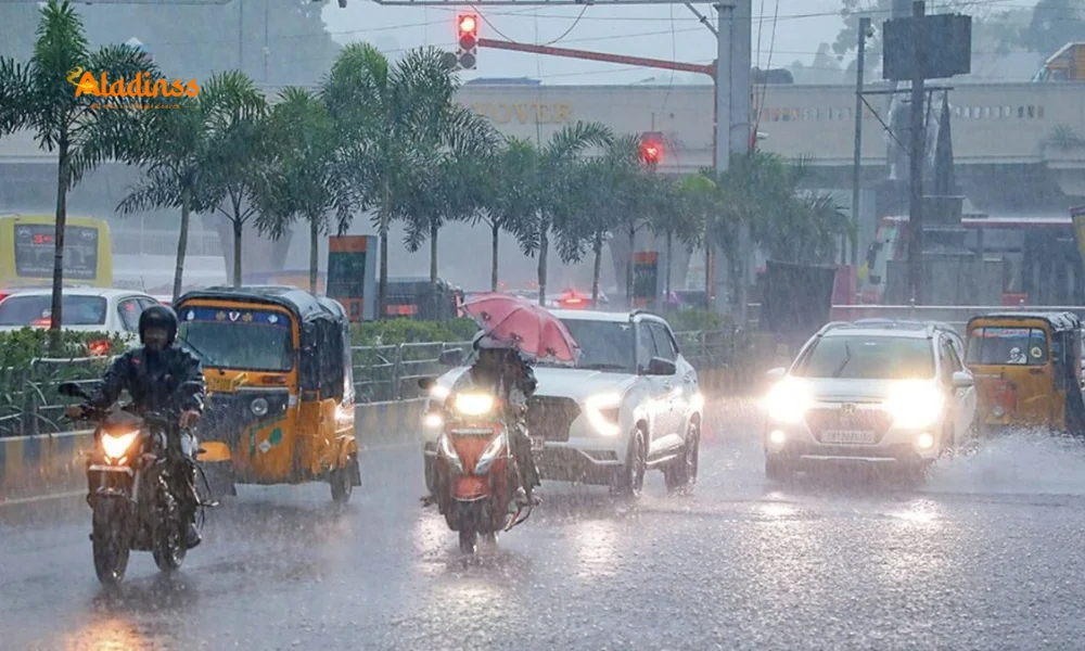
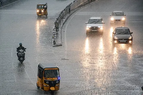
The India Meteorological Department (IMD) has issued a crucial heavy rain alert for Tamil Nadu, signaling potential disruptions across several regions today. With a low-pressure system brewing over southern India, residents in seven districts are bracing for significant rainfall that could lead to waterlogging and traffic issues. This Tamil Nadu rain forecast comes at a time when the state is already experiencing variable weather patterns, emphasizing the need for preparedness amid the monsoon season's unpredictable twists.
In the wake of recent climatic shifts, the IMD's announcement highlights a cyclonic circulation influencing weather over the Arabian Sea and nearby coastal zones. This development is set to bring not just rain but also gusty winds and thunderstorms, affecting daily life from urban centers to rural hinterlands. As the IMD weather update unfolds, locals are urged to stay informed through official channels to mitigate risks associated with sudden downpours.
The core of this weather event stems from a low-level cyclonic circulation hovering above the Gulf of Mannar and adjacent seas. Extending its influence, another similar system lingers over the southeast Arabian Sea near northern Kerala. These atmospheric dynamics are funneling moisture-laden winds towards Tamil Nadu, promising light to moderate showers interspersed with thunder and lightning. Wind speeds could reach 30-40 km/h in isolated spots, adding to the intensity of the rain alert Tamil Nadu scenario.
Districts Under Heavy Rainfall Warning: Impacts and Precautions
The IMD has zeroed in on seven districts where heavy rains Tamil Nadu are most probable: Coimbatore's hilly terrains, Nilgiris, Erode, Krishnagiri, Dharmapuri, Tirupattur, and Vellore. These areas, particularly the elevated landscapes, face the highest risk of flash floods and landslides due to the steep topography that amplifies runoff during intense precipitation. For instance, Nilgiris, known for its lush tea estates, has a history of weather-related disruptions, making this forecast a call for heightened vigilance.
Authorities recommend avoiding travel through vulnerable hill roads and ensuring drainage systems are clear to prevent urban flooding. Farmers in these districts, who rely on timely sowing, might find opportunities in the rain but should watch for soil erosion on slopes. The Tamil Nadu weather alert also extends to Puducherry and Karaikal, where scattered showers could disrupt coastal activities. Overall, this event underscores the broader monsoon forecast Tamil Nadu, where early warnings like these save lives and property.
Beyond immediate impacts, such weather patterns contribute to the state's annual rainfall distribution, which averages around 900-1000 mm during the southwest monsoon. Historical data from IMD shows that districts like Coimbatore have seen up to 100 mm in a single day during similar setups, leading to school closures and power outages. Residents are advised to stock essentials, secure loose objects outdoors, and monitor river levels in low-lying areas to navigate this south India rain update effectively.
Temperature Trends and Chennai's Outlook Amid the Rain Spell
While the rains dominate headlines, temperature across Tamil Nadu, Puducherry, and Karaikal is expected to hold steady with minimal fluctuations. The IMD anticipates a slight dip of 2-3°C in maximums at select locations, keeping conditions cooler than usual. This respite from the typical October heat, where highs often hover around 35°C, could make the Tamil Nadu monsoon rain more tolerable, though humidity levels might soar post-shower.
In Chennai, the metropolis gears up for partly cloudy skies with intermittent light to moderate rain, thunder, and gusts. Maximum temperatures are projected at 34-35°C, dipping to 26-27°C at night—a pattern that aligns with the city's coastal microclimate influenced by the Bay of Bengal. Commuters should prepare for slick roads in areas like Anna Salai and Marina Beach, where puddles often form quickly. The Chennai rain forecast also hints at potential relief for air quality, as rains wash away pollutants accumulated from urban traffic.
Looking ahead, this cooling trend might persist if the cyclonic activity strengthens, potentially extending into the weekend. For those planning outdoor events, checking the hourly IMD rain radar Tamil Nadu updates via apps could be invaluable. Moreover, the slight temperature moderation benefits agriculture, aiding paddy fields in delta regions that thrive under balanced moisture and warmth.
Fishermen Advisory: Steering Clear of Risky Waters
A stern warning accompanies the weather bulletin for fishermen: avoid venturing into high-risk marine zones today. The IMD cautions against outings in south Tamil Nadu's coastlines, the Gulf of Mannar, adjoining Comorin Sea, midwest and northwest Arabian Sea, Karnataka-Kerala shores, and Lakshadweep waters. These areas are prone to cyclonic disturbances that could whip up rough seas and sudden squalls.
With winds potentially exceeding safe limits, small boats face capsizing threats, echoing past incidents where untimely voyages led to losses. Fishing communities in Tuticorin and Ramanathapuram are particularly affected, as their livelihoods depend on daily hauls. Alternatives like shore-based monitoring or delaying trips until the system clears are advised, aligning with the coastal weather alert India protocols.
This advisory extends the IMD's commitment to maritime safety, integrating satellite data and buoy readings for precise predictions. In recent years, such alerts have reduced casualties by over 40%, per government reports, proving their efficacy in safeguarding vulnerable sectors.
Broader Implications: Climate Patterns and Community Resilience
This heavy rainfall Tamil Nadu episode is more than a one-day affair; it reflects evolving climate dynamics in peninsular India. Low-pressure systems like the current one often trace back to warming oceans, intensifying monsoon variability. Experts note that Tamil Nadu's rainfall has increased by 10-15% in the last decade, per IMD analyses, raising flood management challenges in urban sprawls.
Communities are building resilience through initiatives like rainwater harvesting and early warning apps tailored for local languages. Schools and offices in alerted districts may opt for remote operations, while emergency services ramp up patrols. The Tamil Nadu flood alert aspect prompts reviews of infrastructure, ensuring bridges and culverts withstand heavier loads.
On a positive note, abundant rains bolster groundwater recharge, crucial for the drought-prone north interior districts. Hydrologists predict improved reservoir levels at Mettur Dam, benefiting irrigation downstream. As the day progresses, tracking the current weather Tamil Nadu via reliable sources will empower proactive measures, turning potential adversity into manageable weather.
In summary, while the IMD's forecast paints a picture of wet conditions, it also highlights the agency's role in fostering safety. From Coimbatore's hills to Chennai's streets, this rain event reminds us of nature's power and our capacity to adapt. Stay dry, stay safe, and keep an eye on updates for a smoother tomorrow.
Comment / Reply From
No comments yet. Be the first to comment!