Weather Update Heavy Rains Suddenly Fell in Chennai Alert for 7 Districts Today
Weather Alert: Sudden Heavy Rains Disrupt Chennai, Alerts Issued for 7 Districts on November 5
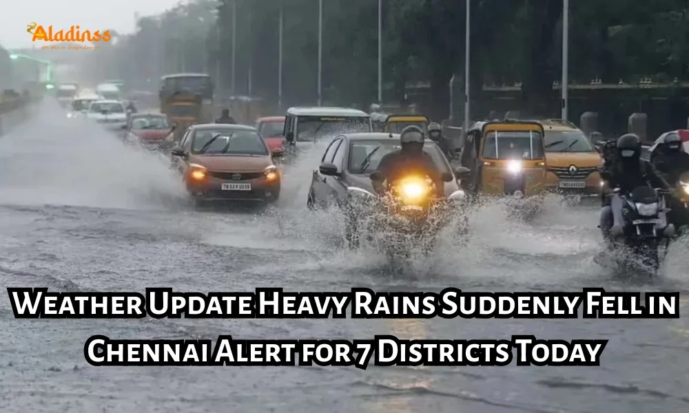
Residents in Chennai woke up to an unexpected downpour on November 5, 2025, as Chennai rain today turned streets into temporary rivers, leading to widespread waterlogging and chaos. The sudden heavy rain in Chennai has caught commuters off guard, particularly in suburban areas where roads like GST Road in Perungalathur saw severe traffic snarls. With the India Meteorological Department (IMD) issuing alerts for seven key districts, including Thanjavur, Thiruvarur, and Nagapattinam, the focus is on preparedness amid this unseasonal burst. This Tamil Nadu weather event stems from a low-pressure circulation over the central-west Bay of Bengal, promising moderate to intense showers across the region.
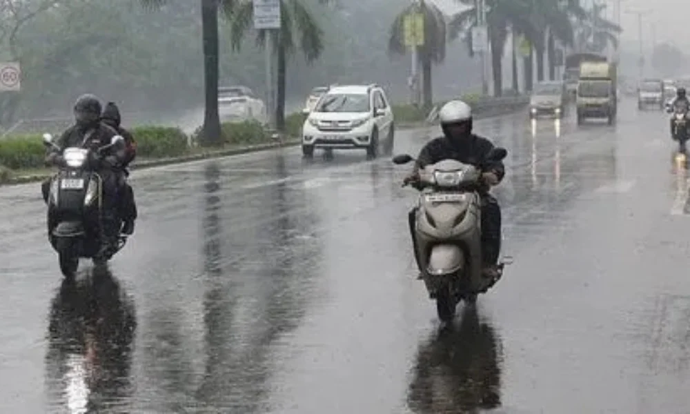
The morning drizzle quickly escalated into heavy spells by evening, affecting neighborhoods from Guindy to Koyambedu. Motorists and pedestrians alike faced hurdles, with low-lying spots transforming into pools that stalled vehicles. As the Chennai weather forecast predicts continuation of these patterns, authorities urge caution, especially for those in vulnerable coastal zones. This isn't just a passing shower; it's a reminder of the region's susceptibility to erratic monsoon-like activities even in November.
Yesterday's light showers gave way to a deceptive sunny interlude, only for the skies to unleash fury later. Areas like Alandur, Pallavaram, and Tambaram bore the brunt, with rainwater seeping into homes and businesses. Farmers in nearby districts, having just recovered from prior inundations, now grapple with renewed concerns over crop damage. The IMD's vigilance highlights the need for timely updates on rain in Chennai, ensuring communities stay one step ahead.
IMD's Detailed Rainfall Forecast for Tamil Nadu on November 5 and Beyond
The IMD attributes this surge in Chennai rain today to a cyclonic circulation lingering off the Andhra Pradesh coast in the Bay of Bengal. Expect moderate rains statewide, but the spotlight is on seven districts primed for heavier downfalls today and tomorrow: Thanjavur, Thiruvarur, Nagapattinam, Mayiladuthurai, Pudukkottai, Ariyalur, and Trichy. These areas could see accumulations exceeding 64.5 mm in isolated pockets, prompting orange alerts for potential flash floods.
Tomorrow's outlook extends the worry to Perambalur, Kallakurichi, Tiruvannamalai, Salem, and Dharmapuri, where similar intensities are forecasted. For Chennai itself, the sky remains overcast with intermittent moderate showers, temperatures hovering between 27°C and 32°C, and humidity levels pushing 80%. Winds from the northeast at 10-15 km/h could gust stronger during peaks, adding to the discomfort.
- Today (November 5): Heavy rain likely in Thanjavur, Thiruvarur, Nagapattinam (over 115 mm possible in spots)
- Tomorrow (November 6): Intensified showers in Pudukkottai, Ariyalur, Trichy, and extensions to Salem
- Chennai Specific: Cloudy with moderate rain; avoid evening travel if possible
- Coastal Advisory: High waves up to 2.5 meters; fishing communities on standby
This pattern echoes the erratic nature of post-monsoon weather in Tamil Nadu, where residual moisture from the Bay often triggers such events. Historical data from IMD shows November contributing 15-20% of annual rainfall in delta regions, underscoring the importance of robust drainage infrastructure.
Also Read: Tamil Nadu School Holiday Due to Heavy Rain Today
Traffic Disruptions and Waterlogging Hotspots in Chennai Suburbs
The heavy rain in Chennai has transformed routine commutes into ordeals, with suburbs hit hardest. On GST Road near Perungalathur, vehicles inched along amid ankle-deep water, leading to hour-long delays for office-goers heading to IT hubs. Selaiyur's main thoroughfares resembled shallow streams, forcing drivers to navigate cautiously to avoid hydroplaning.
Poonamallee and Chembarambakkam fared no better, where stormwater drains overflowed into residential lanes. In Velappanchavadi, a service road turned into an impromptu lake, stranding cars and prompting quick interventions with sandbags at nearby commercial sites. Over 300 such barriers were deployed outside a lorry showroom to shield inventory from ingress. Chromepet and Vandalur reported similar scenes, with local traffic police diverting flows to elevated routes.
Evening peaks exacerbated issues in central spots like Nungambakkam and Alwarpet, where office exodus coincided with the onslaught. Public transport, including MTC buses, faced delays, while auto-rickshaws hiked fares amid the deluge. The Chennai Corporation has mobilized pumps to clear accumulations, but experts note that aging infrastructure struggles with such intensity.
Agricultural Impacts and Farmer Concerns in Delta Districts
Beyond urban woes, the Tamil Nadu weather alert spells trouble for agriculture in the Cauvery delta. In Thiruvarur, relentless rains lashed areas like the old bus stand and Valavaikkal for over an hour, accompanied by gusts up to 40 km/h. Farmers, who had recently pumped out standing water from paddy fields to apply pesticides, now face a setback as fresh inundation threatens yields.
Districts like Thanjavur and Nagapattinam, vital for rice production, report water levels rising in irrigation canals. This could delay harvests or dilute chemical applications, potentially cutting output by 10-15% if prolonged. Agronomists advise elevated storage for inputs and monitoring soil saturation via apps. The event highlights climate variability's toll on smallholders, who comprise 70% of the sector.
Historical parallels from 2023's November floods saw similar disruptions, costing millions in aid. Current relief efforts include seed distribution and crop insurance claims, but proactive measures like raised bunds are gaining traction among cooperatives.
Broader Climate Context and Historical Rainfall Patterns in Chennai
This bout of rain in Chennai fits into a larger narrative of shifting weather paradigms. Chennai's annual rainfall averages 1,400 mm, with northeast monsoons delivering 60% from October to December. Yet, 2025 has seen anomalies, with early withdrawals followed by rebound systems like today's circulation.
Data from IMD's archives reveal November 5 events often tie to Bay of Bengal disturbances, as in 2015's deluge that paralyzed the city. Urbanization exacerbates runoff, with concrete surfaces hastening floods. Studies by IIT Madras estimate a 20% rise in extreme rain days since 2000, linked to warming oceans.
Puducherry, sharing the forecast, braces for parallel impacts. Long-term, initiatives like sponge city projects aim to absorb excess via green infrastructure. For now, satellite imagery tracks the system's evolution, aiding precise warnings.
Safety Tips and Preparedness Measures for Residents Amid Heavy Rains
As Chennai weather forecast signals persistence, safety comes first. Avoid flooded underpasses and wade through water only if depth is below knee-level. Keep emergency kits with torches, first-aid, and charged phones handy. For vehicles, check tire treads and maintain distance to prevent aquaplaning.
- Monitor IMD apps for real-time heavy rain in Chennai updates
- Secure loose items outdoors against winds
- Farmers: Elevate equipment and livestock to higher ground
- Urban dwellers: Clear home gutters to avert backups
- Report hazards via civic helplines like 1913
Schools in alerted districts may shift to online modes, while offices encourage work-from-home. Hydropower stations along rivers are on watch for overflow risks. Community watches in apartments have proven effective in past events, fostering neighborly aid.
Economic Ripples and Government Response to the Rainfall Event
The Chennai rain today episode carries economic undertones, disrupting supply chains in manufacturing belts like Sriperumbudur. Retail footfall dips as shoppers hunker down, impacting small vendors. Tourism, already seasonal, sees cancellations for beach outings.
Tamil Nadu government has activated control rooms, deploying NDRF teams if escalations occur. Chief Minister's office announced ex-gratia for affected families, drawing from cyclone funds. Infrastructure upgrades, including Rs. 1,000 crore for desilting, are fast-tracked post this wake-up call.
On a positive note, rains replenish reservoirs like Chembarambakkam, easing water scarcity fears for summer 2026. Hydrologists predict a 5-7% groundwater boost if patterns hold.
Looking Ahead: Weekly Weather Outlook and Climate Resilience Strategies
Peering into the week, IMD foresees tapering showers by November 8, with dry spells returning mid-month. However, another low-pressure area may brew by November 10, keeping vigilance high. For Tamil Nadu weather, integrating AI-driven models promises sharper predictions.
Resilience building involves community drills and eco-friendly urban planning. NGOs like Blue Cross aid animal welfare during floods, while tech startups develop flood-mapping drones. As Chennai navigates this, collective action turns challenges into fortified futures.
In wrapping up, November 5's heavy rain in Chennai underscores nature's unpredictability, but with informed steps, impacts can be minimized. Stay tuned for updates, prioritize safety, and embrace the refresh that rains bring to our coastal gem.
Facebook Comments


-
 Explore the upcoming Tamil film Maaman - cast, sto...
 -
 Read the ACE (2025) movie review starring Vijay Se...
 -
 Check out Maaman's 1st day box office collection a...
 -
 Explore tourist family reviews for Maaman movie –...
Popular Posts
Vote / Poll
Recent Posts


Recommended Posts

-
 Discover the best schools in Nagercoil f...
 -
 Discover the top-rated preschools in Nag...
 -
 Explore the best schools in Nagercoil th...

Comment / Reply From